
Super Volcano
Click links
or pictures
to go to larger images
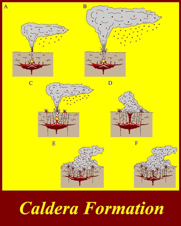
http://www.mmdtkw.org/ALRIVes0901CalderaFormation.jpg
Calderas are formed when surface formations collapse into voids caused
by expulsion of magma. Some calderas are formed inside existing
volcanic cones, but the "supper" calderas are often just huge
depressions without a surrounding cone.
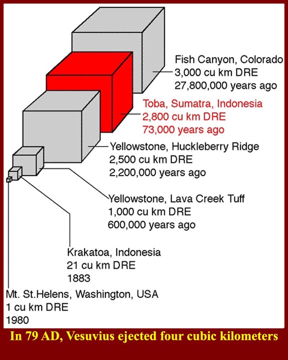
http://www.mmdtkw.org/ALRIVes0902ComparativeEjecta.jpg
The graphic shows the amount of ejecta in some prehistoric eruptions
that produced "super" calderas and compares that with the ejecta of
much smaller recent eruptions. The 79 AD Vesuvius eruption would
have fallen between the two smallest blocks. The known death toll
of the 79 AD eruption-- essentially, the bodies recovered since Pompeii
and the surrounding communities were rediscovered -- was also not
extraordinarily large for volcanic eruptions, but there may have been
many more killed in the countryside. We are forced to consider
why that particular eruption has caught our imagination. Acronyms:
DRE = Dense Rock Equivalents.
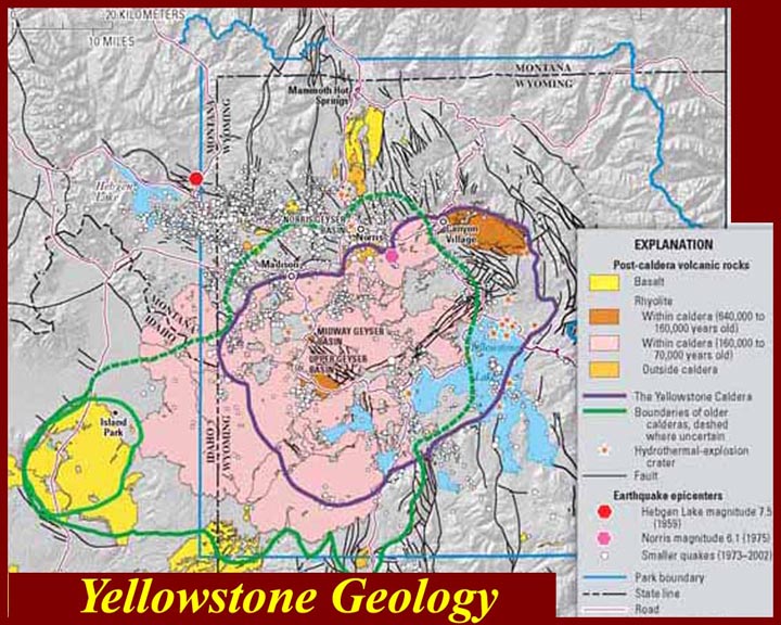
http://www.mmdtkw.org/ALRIVes0903YellowstoneGeology.jpg
Geology of the Yellowstone caldera.
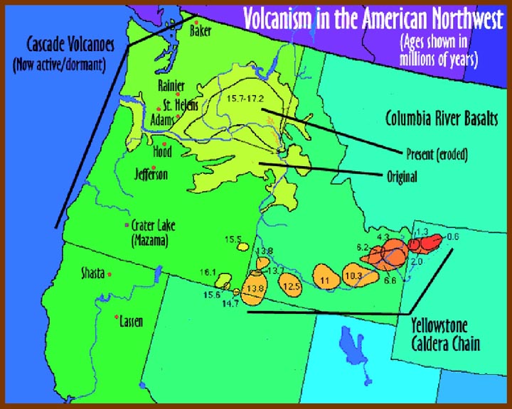
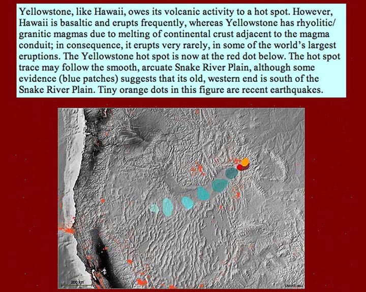
http://www.mmdtkw.org/ALRIVes0904NWUSVolcanism.jpg
Volcanism in the US Northwest. Two different kinds of volcanism
are present: (1) in the Pacific Northwest, the Cascade
Range volcanoes are caused by subduction, while (2) the activity in the
interior (along the Snake River Valley) is the result of a "hot spot",
possibly fed by a "super plume" the stretches well down into the mantle
of the Earth. Although it looks like the "hot spot" is
drifting to the northeast, scientists believe that the continental
crust is what is in motion, toward the southwest.
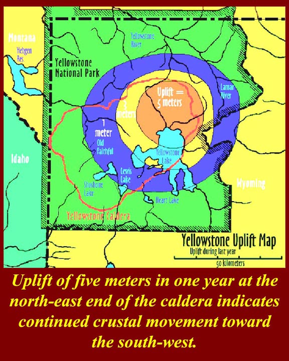
http://www.mmdtkw.org/ALRIVes0905YellowstoneUpliftMap.jpg
Five meters of uplift in a single year seems like a lot, but USGS
scientists are not unduly concerned, because it is occurring over a
very
wide area and, thus, does not appear to be overstressing the surface at
any particular spot -- a five meter bulge in one or two kilometers of
surface would be a problem. Nonetheless, this not so "brady" (=
slow) bradyseism indicates an increase of subsurface pressure, which
USGS is closely monitoring.
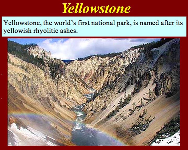
http://www.mmdtkw.org/ALRIVes0906RhyoliticYellowAsh.jpg
The yellow stone at Yellowstone is rhyolitic yellow ash -- fine
particles of yellow rhyolite that are somewhat consolidated.
Rhyolite is a fine-grained extrusive volcanic rock, similar to granite
in composition and usually exhibiting flow lines (not usually visible
at yellowstone due to the fact that it was deposited as "ash").
Rhyolite is highly acidic and has approximately 69 percent silica
and high concentrations of potassium and sodium.
http://www.mmdtkw.org/ALRIVes0907HotSpotMovement.jpg
The motion of the Yellowstone hot spot appears to be along the course
of the Snake River. What actually happened was that the drainage
pattern developed along the line of prehistoric calderas generated as
the continental crust slid over the hot spot. For more
information on the Snake River and the hot spot, see
http://volcano.und.edu/vwdocs/volc_images/north_america/yellowstone.html
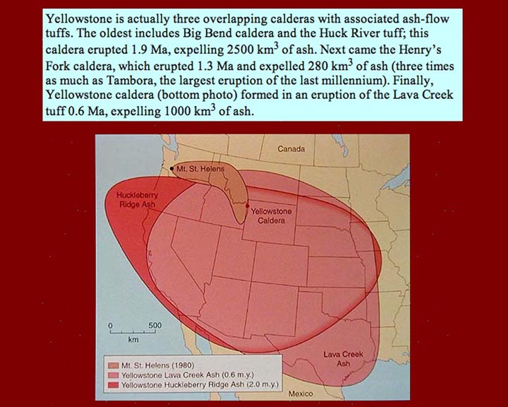
http://www.mmdtkw.org/ALRIVes0908OverlappingCalderas.jpg
The map shows overlapping ash falls from successive caldera-forming
eruptions caused by what is now the Yellowstone hot spot.
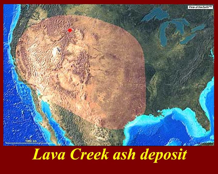
http://www.mmdtkw.org/ALRIVes0909LavaCreek.jpg
The Lava Creek ash fall was the result of the eruption that produced
the Yellowstone Basin caldera. That eruption occurred about
600,000 years ago. Since the last three major eruptive events of
the hot spot were about 600,000 years apart, there has been much public
speculation -- mostly by non-experts, but including some volcanologists
-- that another major eruption is
"due" or "overdue". Many volcanologists disagree, pointing out
that
three events are not enough to establish regularity and that the
structures of
zircon and quartz crystal within the ejecta of the three events
indicate a waning cycle.
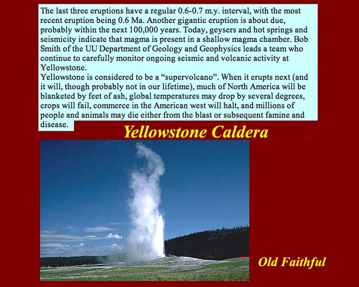
http://www.mmdtkw.org/ALRIVes0910OldFaithful.jpg
Old Faithful is a surface indicator of the subsurface heat of the
Yellowstone caldera. The text is from a volcanologist of
the "eruption is due" school.
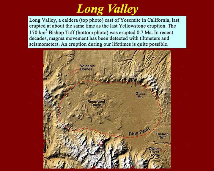
http://www.mmdtkw.org/ALRIVes0911LongValley.jpg
Long Valley in California east of Yosemite is another western super
caldera that last erupted about the same time as the Yellowstone
eruption. The product of the Long Valley eruption is known as the
Bishop Tuff. Tuff, as we know, is consolidated ash.
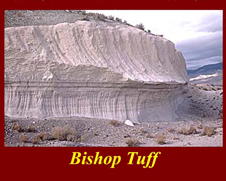
http://www.mmdtkw.org/ALRIVes0912BishopTuff.jpg
An exposure of the Bishop Tuff.
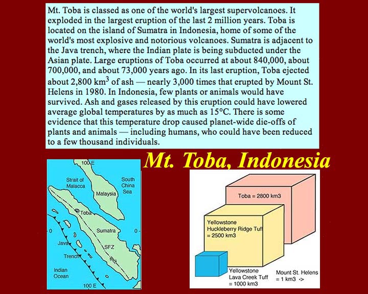
http://www.mmdtkw.org/ALRIVes0913Toba.jpg
Mount Toba in Indonesia is one of the largest super volcanoes. 73,000
years ago it spewed 2800 cubic kilometers of ash that lowered the
temperature of the whole planet and caused massive die-offs -- it was a
major contributor to that era's "natural selection" of humans and other
terrestrial life. That 2800 cubic kilometer eruption was almost
3000 times the size of the Mt. St. Hellens eruption of 1981.
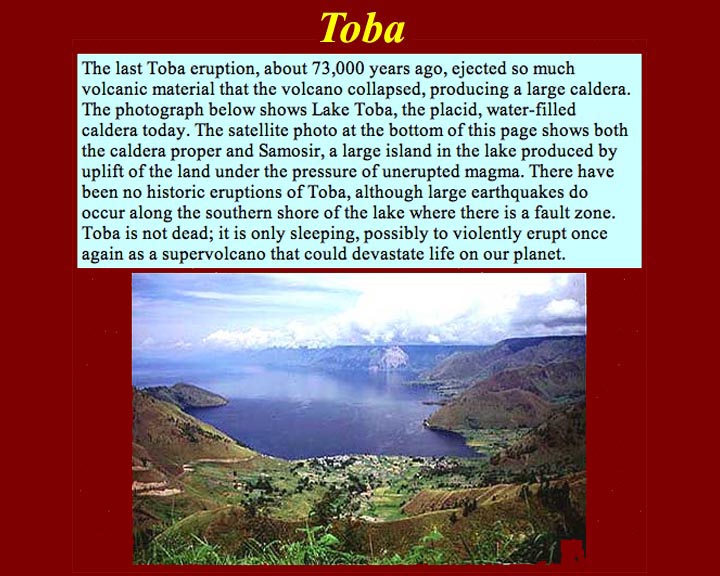
http://www.mmdtkw.org/ALRIVes0914LakeToba.jpg
Lake Toba is the water-filled caldera of the eruption of 73,000 years
ago.
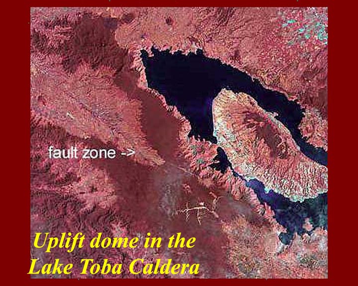
http://www.mmdtkw.org/ALRIVes0915LakeTobaIsland.jpg
The Lake Toba island is a volcanic uplift dome.
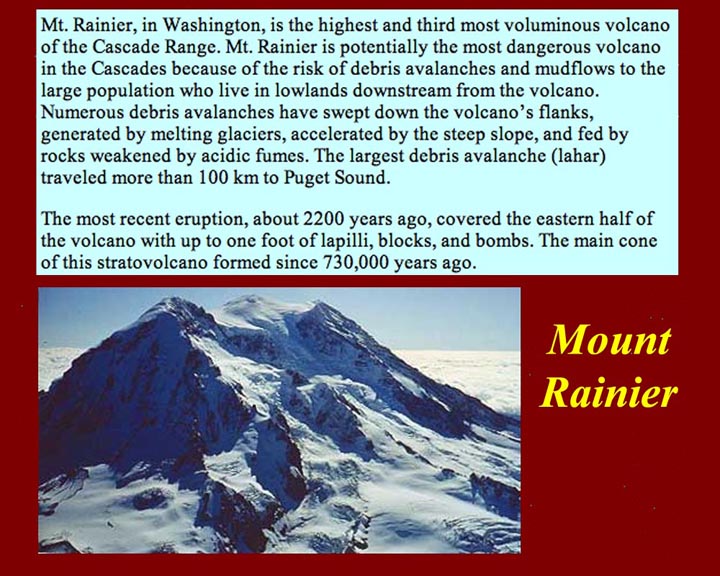
http://www.mmdtkw.org/ALRIVes0916Rainier1.jpg
The last eruption of Mt. Rainier was about 2200 years ago, but
destructive lahars have
occurred much more recently. Lahars
are mud and water flows caused by glacier melt due to volcanic heat or
due to rain water mixing with loose ash. The Rainier lahars are exacerbated by crumbling
rock caused by vocanic acid fumes.
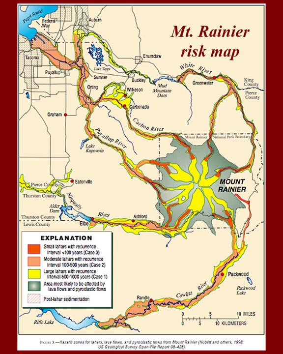
http://www.mmdtkw.org/ALRIVes0917aRainierRiskMap.jpg
The current Mt. Rainier risk map shows expected routes of lahars and extent of possible
pyroclastic flows from
the volcano. Text of the risk report specifies that pyroclastic
flows are not expected to be omni-directional and also that all
projections are approximate. Day-to-day risk information for this
and other Pacific Northwest volcanoes is available on the Internet from
the USGS Cascade Volcano Observatory at http://vulcan.wr.usgs.gov/
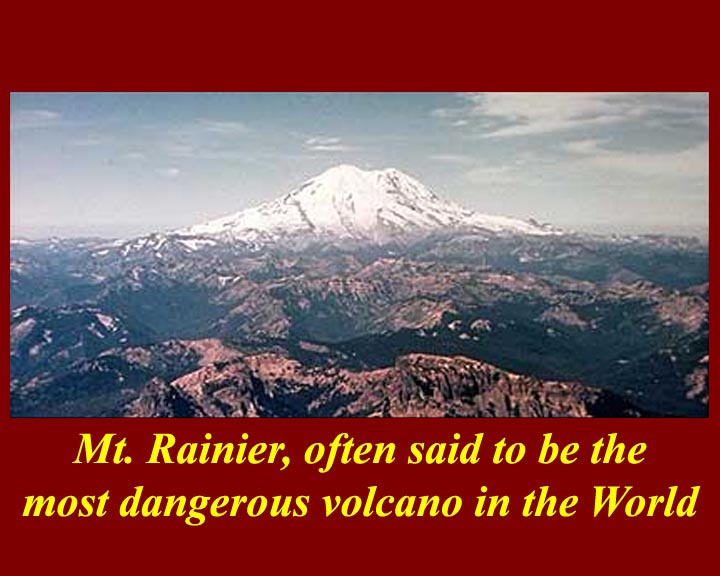
http://www.mmdtkw.org/ALRIVes0917Rainier2.jpg
Mt. Rainier is often cited as the world's most dangerous volcano,
because it is close to major population centers. It's only real
competition in this regard is Vesuvius.
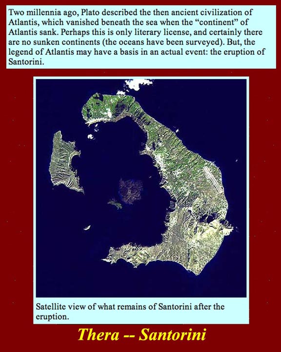
http://www.mmdtkw.org/ALRIVes0918Santorini.jpg
The explosion of the Mediterranean island of Santorini, ancient Thera,
is thought to have been the basis for the Atlantis legend.
Santorini is 70 miles north of Crete.
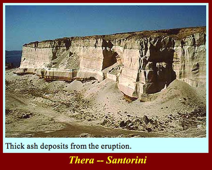
http://www.mmdtkw.org/ALRIVes0919SantoriniAshFall.jpg
The size and precise date of the Thera/Santorini eruption are not
precisely known, but the ash deposits throughout the eastern
Mediterranean area are manifest. Some volcanologists and
archeologists attribute the end of the Minoan civilization, which was
centered in Crete, to the eruption and its tsunami after-effects, and
the biblical "parting of the Red Sea" by Moses is also sometimes tied
to the eruption (but much less persuasively).
http://www.mmdtkw.org/ALRIVes0920SantoriniMinoan.jpg
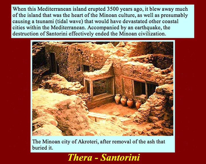
The Thera/Santorini eruption (about 3500 years ago) destroyed a Minoan
city on Thera now known as "Akroteri".
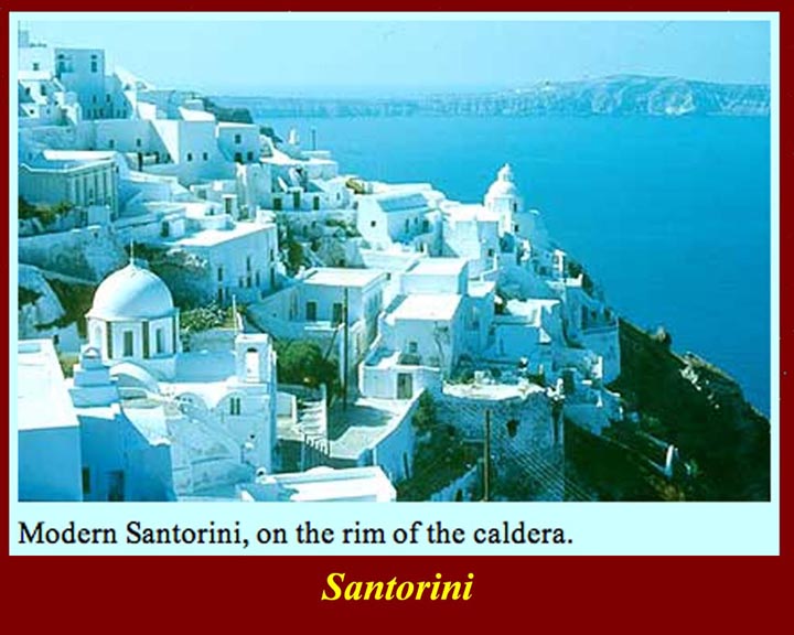
http://www.mmdtkw.org/ALRIVes0921SantoriniModern.jpg
Santorini town, on of those wonderful white Greek Island towns, is on
the
rim of the caldera.
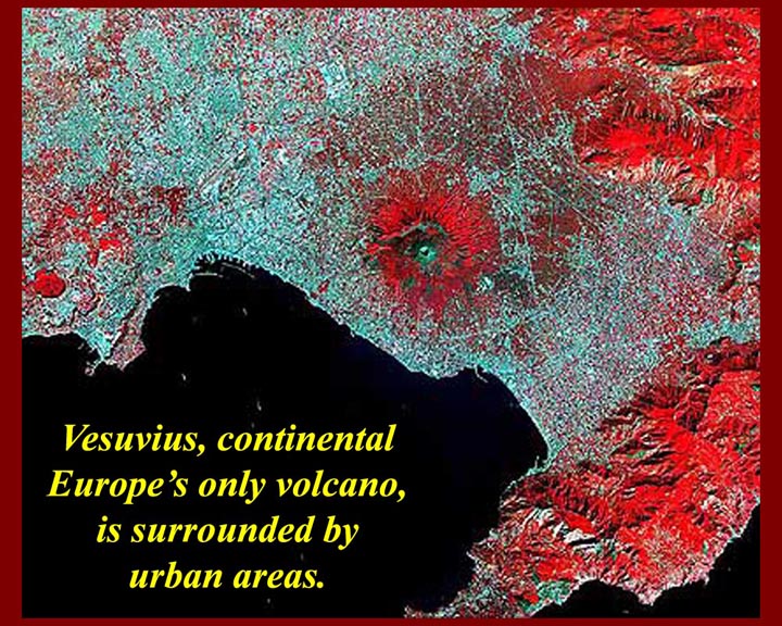
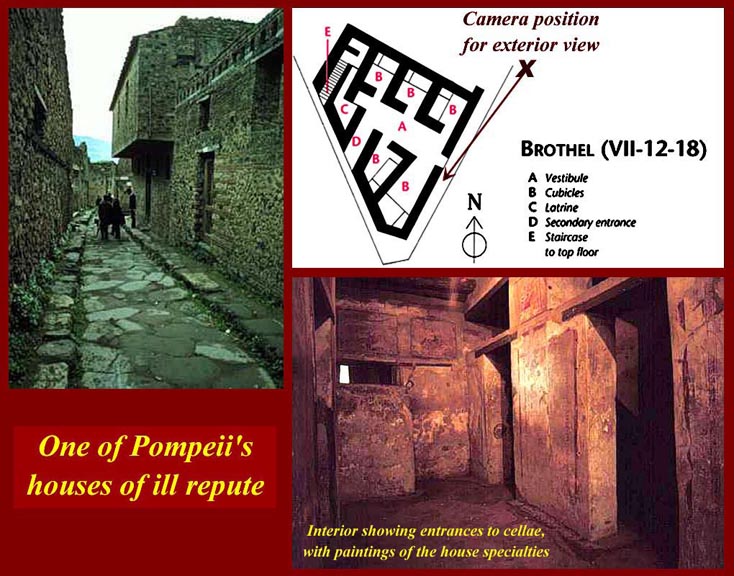
http://www.mmdtkw.org/ALRIVes0922VesuviusMegalopolis.jpg
Vesuvius, the
star of this, is a contender for the "most dangerous volcano"
title. Like Mt. Rainier, it is densely populated.
http://www.mmdtkw.org/ALRIVes0923Krakatoa1.jpg
If you saw the 1969 movie Krakatoa
East of Java, you know the story -- sort of.
Even the title was wrong: Krakatoa is west of Java.
The 1883 eruption was heard in Australia and tsunami circled the whole
planet. It was a major explosion but small potatoes compared to the
ancient supervolcano eruptions. Toba, remember, blew out 2800
cubic kilometers of ejecta: Krakatoa's products were a paltry 20
cubic kilometers. Nonetheless, Krakatoa's eruption was called the
largest in "modern times" -- meaning since about 1815.
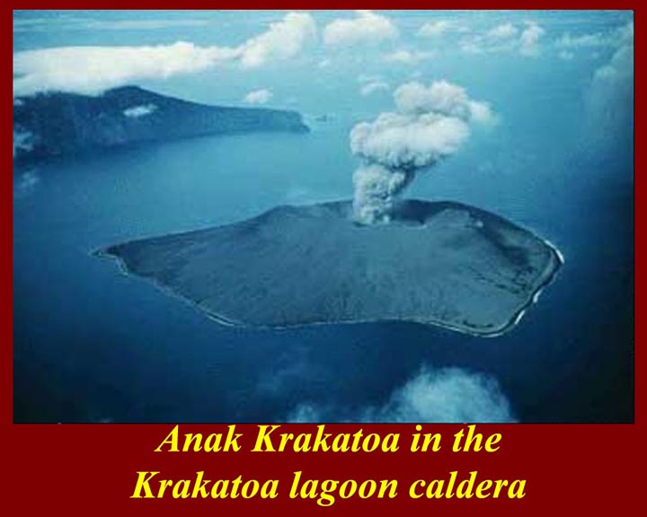
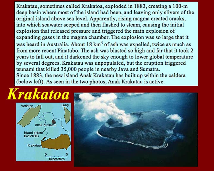
http://www.mmdtkw.org/ALRIVes0924Krakatoa2.jpg
A new volcano has grown in the center of the Krakatoa lagoon. It
has been active since 1883, and the locals like it that way: a slow
release of pressure is better than building up for another cataclysmic
event.
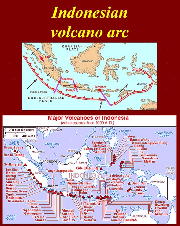
http://www.mmdtkw.org/ALRIVes0925KrakatoaInIndonesia.jpg
Krakatoa is just one of dozens of "major volcanoes" in Indonesia.
The really big one is Tambora (and it also really is east of
Java). The reason that all of those volcanoes are there is that
the Indo-Australian plate is rapidly pushing under the Eurasian plate.
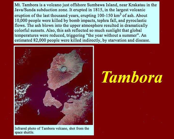
http://www.mmdtkw.org/ALRIVes0926Tambora.jpg
Tambora's eruption in 1815 was the biggest in the last 1000
years: it put out about 100 to 150 cubic kilometers of ash.
Tens of thousands died of starvation and disease when crops failed in
the "year without a summer".
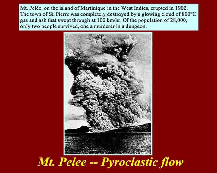
http://www.mmdtkw.org/ALRIVes0927Pelee1902.jpg
Mt. Pelee's 1902 eruption in Martinique was a
world-wide
sensation because it was the first to be photographically documented
and the first at which expert volcanologists were present as
witnesses. The "glowing cloud" -- now called a pyroclastic flow
-- killed all but two (one by some accounts) of the 25 to 30,000
inhabitants of St. Pierre. (The "sole survivor" was Ludger
Sylbaris, a twenty-seven-year-old laborer who had spent the night of
the eruption in jail for his involvement in a bar fight. He was
badly burned. Sylbaris was quickly hired for the side-show if P.
T. Barnum's circus and was billed as as "the Most Marvelous Man
in the World".)
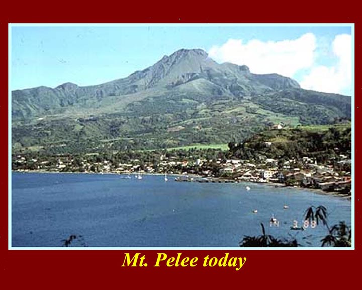
http://www.mmdtkw.org/ALRIVes0928PeleeToday.jpg
Mt. Pelee today. The 1902 eruption was the eponymous Peleean
eruption, and the identification of the Peleean "glowing cloud" was the
start of our understanding of volcanic events.
http://www.mmdtkw.org/ALRIVes0929PinatuboBefore.jpg
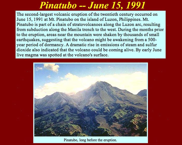
June 15, 1991 brought the eruption of Mt. Pinatubo in the Philippines
-- another of the volcanoes in the pacific "ring of fire". Its
phreatic eruption, after 500 years of dormancy, was preceded by
tremors, oozing lava, and numerous fumaroles.
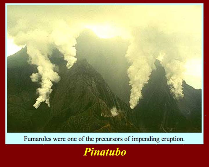
http://www.mmdtkw.org/ALRIVes0930PinatuboPrecursors.jpg
Fumaroles as precursors at Pinatubo.
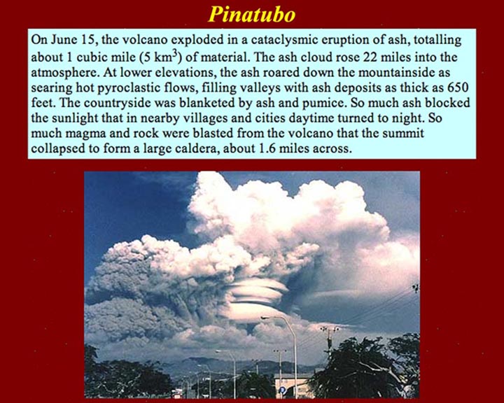
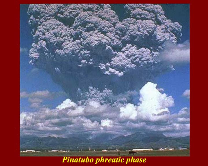
http://www.mmdtkw.org/ALRIVes0931PinatuboExplosion.jpg
Pinatubo's Phreatic explosion. The Pinatubo eruption was the
second largest in the 20th century.
http://www.mmdtkw.org/ALRIVes0932PinatuboDistantExplosion.jpg
Pinatubo from a safer distance.
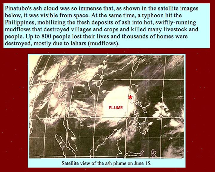
http://www.mmdtkw.org/ALRIVes0933PinatuboSpacePlume.jpg
A Pacific typhoon struck the Philippines sat the same time that
Pinatubo was erupting. Typhoon rains mixed with volcanic ash to
cause deadly lahars.
This is a view from space -- the safest distance of all.
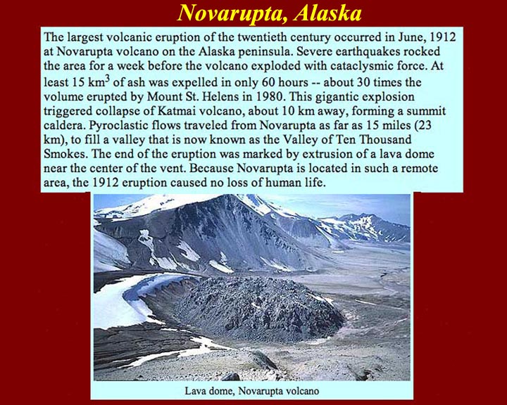
http://www.mmdtkw.org/ALRIVes0934NovaruptaAlaska.jpg
Novarupta one of several volcanoes on the Alaska Peninsula, provided
the largest volcanic fireworks display of the 20th century in 1912 --
and nobody saw it happen. It was entirely undocumented until
several years later. For more information on Novarupta and the
Katmai go to: http://volcano.und.edu/vwdocs/volc_images/north_america/alaska/katami.html.
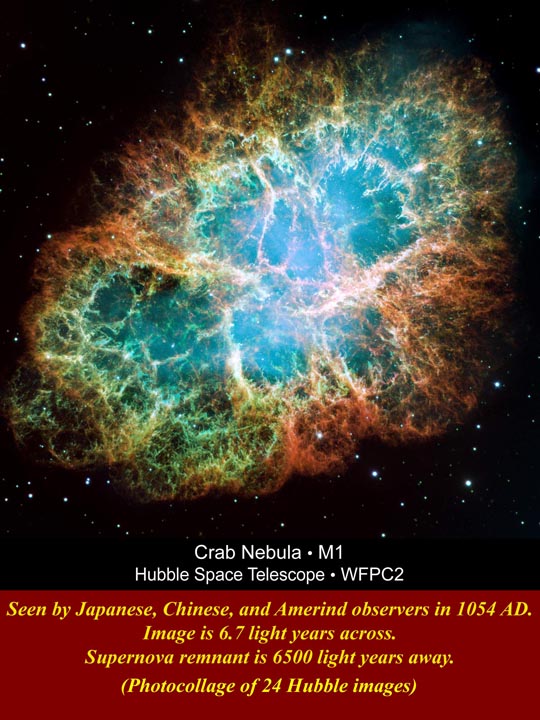
http://www.mmdtkw.org/ALRIVes0935CrabNebula.jpg
Perspective: Large and impressive as volcanoes are -- even
super-volcanoes -- they don't match nature's really big
fireworks: supernova explosions. The Crab Nebula is the
remnant of a not particularly large supernova. It's notable
because it was seen and recorded
in both the old world, by Chinese and Japanese astronomers, and the new
world, by Amerind observers. The observations took place in 1054
AD, but the explosion took place about 5700 years earlier: the
Crab Nebula is 5700 light years away.The width of the image is a little
more than 6.7 light years or about 38 trillion miles. The
diameter of the Solar system is a bit less than one fifth the diameter
of the nebula.