Campi Flegrei Click links
or pictures
to go to larger images
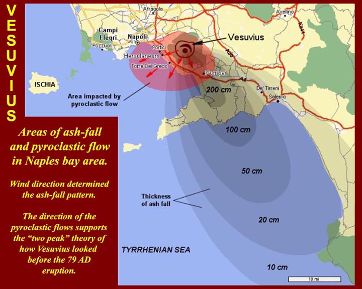
http://www.mmdtkw.org/ALRIVes0801VeseEruption79ad.jpg
The 79 AD eruption of Vesuvius washed over the Bay of Naples, and,
according to Pliny the Younger, the cloud of dust and debris associated
with the climactic pyroclastic flow reached Misenum at the far western
end of the Gulf of Puteoli (Pozzuoli).
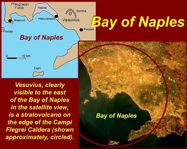
http://www.mmdtkw.org/ALRIVes0802NaplesBay.jpg
The ancient Romans called the Bay of Naples the "Crater", by which they
meant that it was shaped like a bowl. Actually, the bay and the
Campi Flegrei to the north are both just parts of a single large
volcanic caldera.
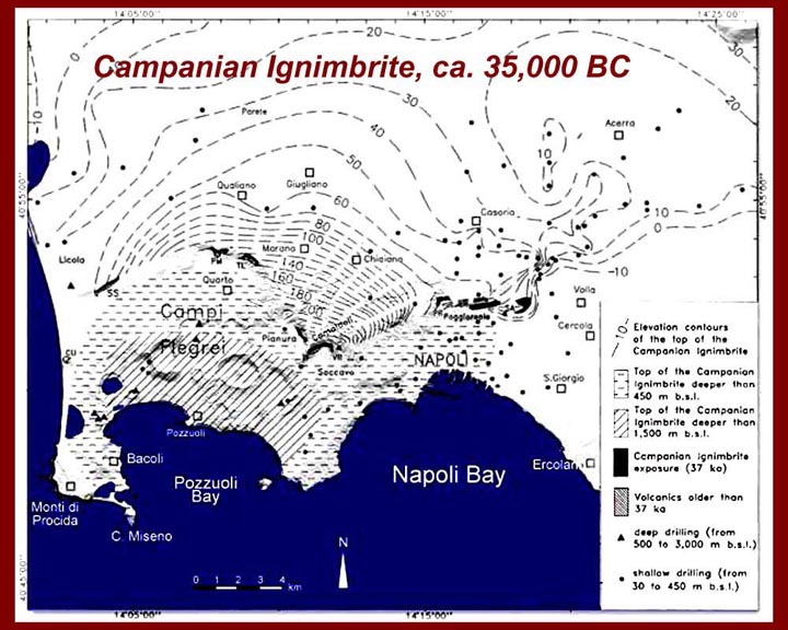
http://www.mmdtkw.org/ALRIVes0803CampanIgnimbrite.jpg
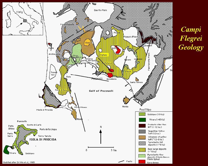
Inside the northern edge of the Bay of Naples Caldera is a smaller
Caldera called the Campi Flegrei, which was formed about 37,000 years
ago: a huge eruption deposited the "Campanian Ignimbrite", and
the Campi Flegrei caldera came into being when the magma chamber
collapsed.
Another major cycle of eruptions ended 12000 years ago with the
deposition of the "Neapolitan Yellow Tuff" and additional magma chamber
collapse. Since that time there have been numerous smaller
eruptions from more than 60 "volcanic centers" in the Campi
Flegrei. All this activity has caused an extremely jumbled
volcanic field with numerous large and small craters and fissures.
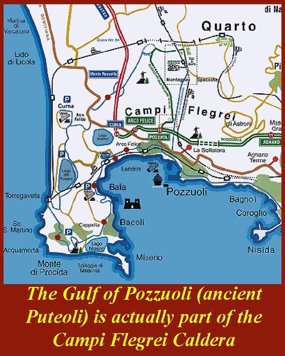
http://www.mmdtkw.org/ALRIVes0804GulfPozzuoliMap1.jpg
A large portion of the Campi Flegrei caldera is under water in the Gulf
of Pozzuoli and in the Mediterranean Sea to the west of the Procida
Peninsula. (Note that Monte Procida is on the peninsula to the
west of Misenum. A different geographical feature, just off
the bottom of this map, is called Procida Island -- it will be in
another image, below.)
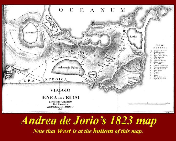
http://www.mmdtkw.org/ALRIVes0805DeJorioMap.jpg
Vergil, in his Aenead, sets the visit of Aeneas to the Underworld in
the Campi Flegrei where one of the volcanic craters, Lacus Avernus, was
well known as an entrance to Hades. Various locations in the
Campi Flegrei are easily identified in Vergil's text, but there were
centuries-long debates about where other features might be. In
1823, Andrea de Jorio wrote what he thought was a definitive study of
where all Vergil's locations were -- and he included this map.
Note that North is on the bottom of the map.
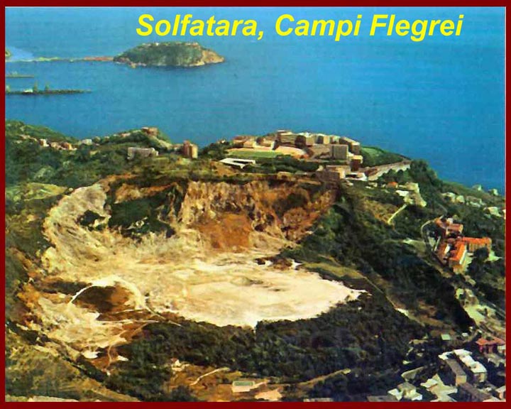
http://www.mmdtkw.org/ALRIVes0807Solfatara.jpg
Solfatara has been, since ancient Roman times, a health resort where
sulfurous fumes and waters are said to cure a variety of pulmonary and
gastric ills. It is also one of the hot spots in the Campi
Flegrei -- boiling mud, steam vents, occasional sulfur lava. One
side of the crater is much hotter than the other: it's important
to stay on the wooden pathways to avoid sinking though the thin
crust. According to local legend, as long as Solfatara boils
there will be no eruption of Vesuvius.
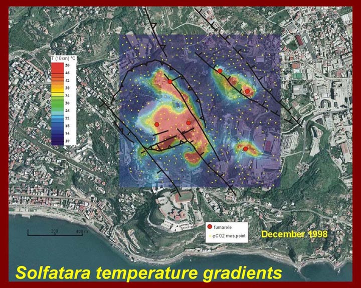
http://www.mmdtkw.org/ALRIVes0808SolfataraTemps.jpg
The image shows temperature gradients inside the Solfatara crater in
december of 1998. Such readings are taken at least monthly and
much more often when surface movement (rising or falling) is detected.
http://www.mmdtkw.org/ALRIVes0809SolfataraMap.jpg
The side of the crater that is cooler and less active is a tourist
camp. The church of St. Januarius (San Genaro) is just outside
the crater. Neapolitans pray to Januarius for protection against
Vesuvius. Local lore speaks of Januarius being beheaded on the
rim of Solfatara. The martyr's head tumbled down to where the
church now stands, singing and praying until it stopped rolling.
On the feast of San Genaro, a vial of his blood is displayed in the
Naples Duomo, and it miraculously liquefies thus reassuring Neapolitans
that Vesuvius will stay quiet for another year.
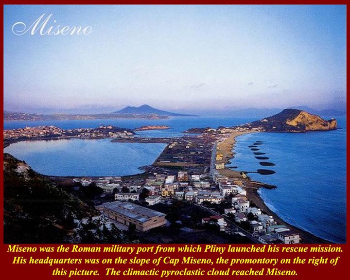
http://www.mmdtkw.org/ALRIVes0810Miseno.jpg
Admiral Pliny, the Elder, watched over his military fleet in the
natural double harbor from a villa on the slope of Cap Miseno at the
western end of the Gulf of Puteoli. Before launching the fleet on
his fatal rescue mission in 79 AD, he climbed to the top of Capo Miseno
for a better view of the eruption.
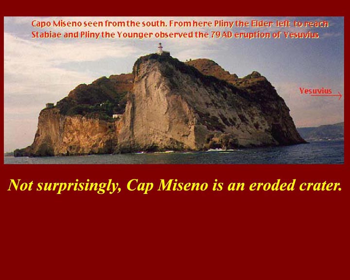
http://www.mmdtkw.org/ALRIVes0811CapoMiseno.jpg
The small eroded crater that is Capo Miseno is a natural fortress, but
it was too far away from the cities around the Bay of Naples to launch
effective protective missions -- either from Vesuvius, or, later, from
lightning raids by barbarian pirates.
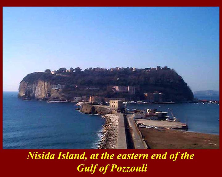
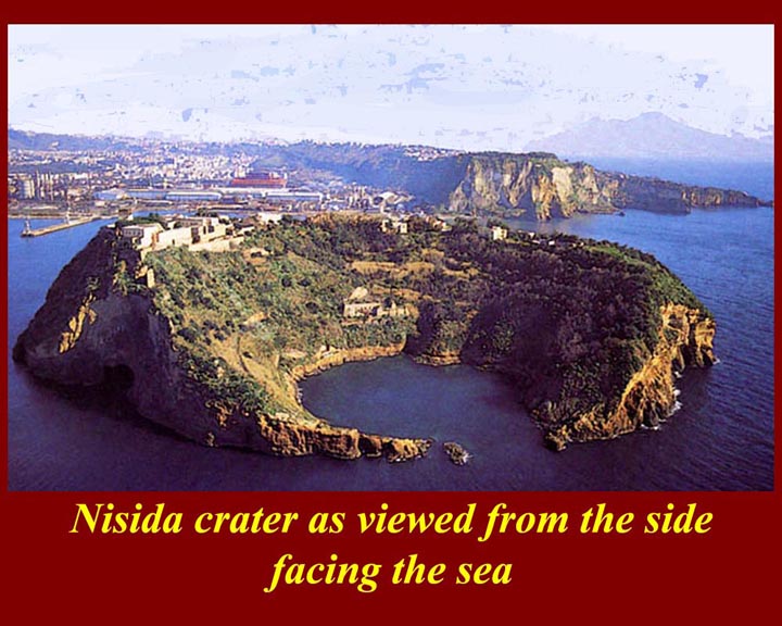
http://www.mmdtkw.org/ALRIVes0812NisidaShoreSide.jpg
Guarding the eastern end of the Gulf of Puteoli is the fortress island
of Nisida. The Naples port is today the major entrepot on the Bay
of Naples, but in ancient Roman times Puteoli was the big port.
It survived the 79 AD eruption and quickly was back in business.
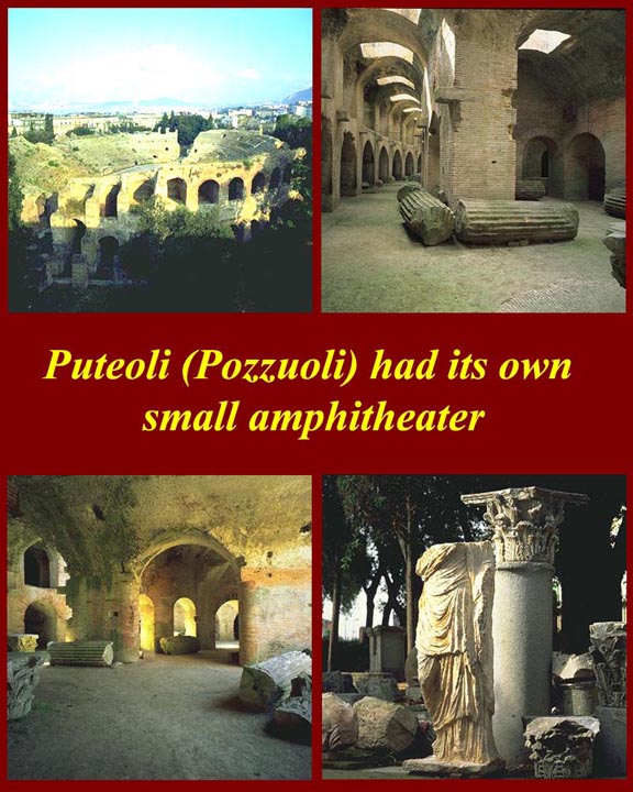
http://www.mmdtkw.org/ALRIVes0814PuteoliAmphitheatre1.jpg
Puteoli was big enough to have its own amphitheater -- in fact, two of
them. This one, the larger, was built by Domitian, the younger
brother of Titus, who was emperor when Vesuvius erupted in 79 AD.
It seated about 40,000 and thus was twice as large as the on in
Pompeii. Puteoli also had a theater and a circus (chariot race
course).
http://www.mmdtkw.org/ALRIVes0816IllustBalneisPuteolanis.jpg
The town name Puteoli is derived from a Greek word meaning "sulfur
springs". Puteoli's hot sulfur baths were and are famous
throughout Europe as curative spas. The images are illustrations
from a Medieval advertising brochure for Puteoli's services, pages of
which are in two Vatican libraries.
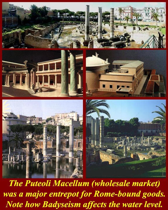
http://www.mmdtkw.org/ALRIVes0817PuteoliMacellum.jpg
Puteoli's macellum (wholesale
market) was where entrepreneurs bought and sold ships' cargoes.
It was long mis-identified as a Temple of Serapis, mostly on mistaken
architectural grounds -- what was probably a circular trading floor in
the center looked like a Serapion
(which was a Greek-Egyptian water temple) because it was
semi-submerged. Eventually, scholars and geologists figured out
that it was sunken due to bradyseism, slow raising and lowering
of ground levels due to underlying magma movements. The macellum is now above the level of
the
Bay waters due to "inflations" of the 1970s and 1980s.
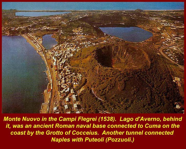
http://www.mmdtkw.org/ALRIVes0818LAverno.jpg
Lacus Avernus (Lago d'Averno) is in one of the defunct craters of
the Campi Flegrei. in ancient times it was connected by canals to the
Baiae Bay, a small feature of the Gulf of Puteoli, right side of the
picture. During the time of Augustus, Marcus Agrippa had a tunnel
dug from Lacus Avernus to the old Greek colony of Cumae on the
Mediterranean (top) by his great tunnel engineer Cocceius.
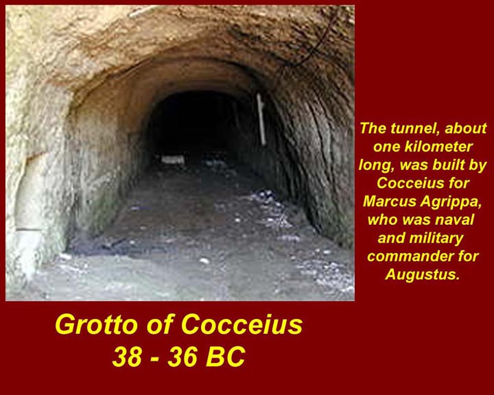
http://www.mmdtkw.org/ALRIVes0819CocceiusGrotto.jpg
The Lago d'Averno end of the Grotto of Cocceius. The other end
connected with pre existing tunnels under the acropolis of Cumae (one
of which has been identified as the cave of the Cumaean Sibyl.)
Cocceius also built another tunnel for Agrippa connecting Puteoli with
Naples. Both tunnels were damaged during W.W.II, and they are no
longer open to tourists.
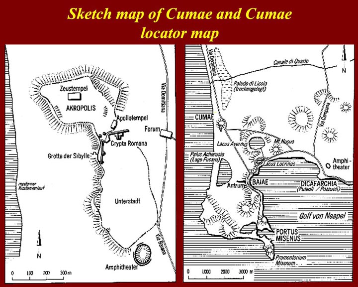
http://www.mmdtkw.org/ALRIVes0820CumaeMaps.jpg
Maps of Cumae and the Procida Peninsula. Cumae had an upper level
(acropolis) on a tufa hill and a lower residential area. The
acropolis hill was honeycombed with tunnels, which probably were
originally quarries but later became storage areas and, in some cases,
acquired religious significance.
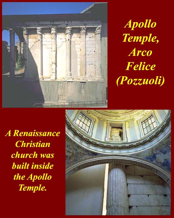
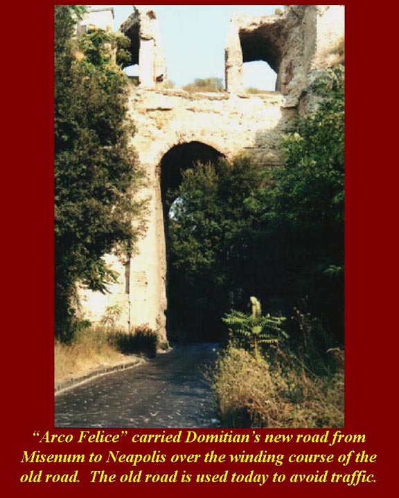
http://www.mmdtkw.org/ALRIVes0821ArcoFelice.jpg The Arcus Felix (Arco Felice) carried Domitian's new straighter
road from Misenum to Neapolis over the old winding road.
Domitian's road has fallen from the arch, and the ancient road below is
used by knowledgeable locals to avoid superhighway traffic.
Domitian, who took over the imperial throne when his older brother
Titus died in 81 AD undertook major rebuilding projects in the Naples
Bay area, but made no effort to revive the Port of Pompeii, which,
after the 79 AD eruption, was 1500 meters from the new shoreline.
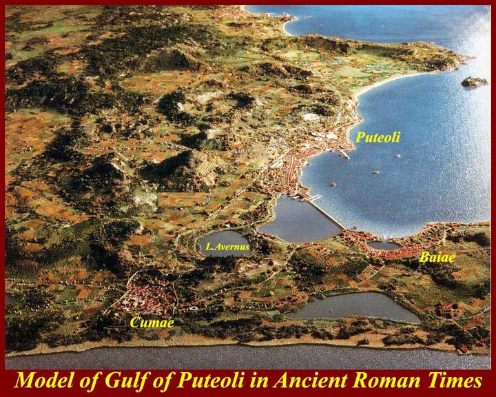
http://www.mmdtkw.org/ALRIVes0822Plastico_CampiFlegrei.jpg
A model of the Campi Flegrei as the area looked at the time of the 79
AD eruption. The harbor between Lacus Avernus and the Baiae Bay
is now dry having been uplifted ("inflated") over the centuries.
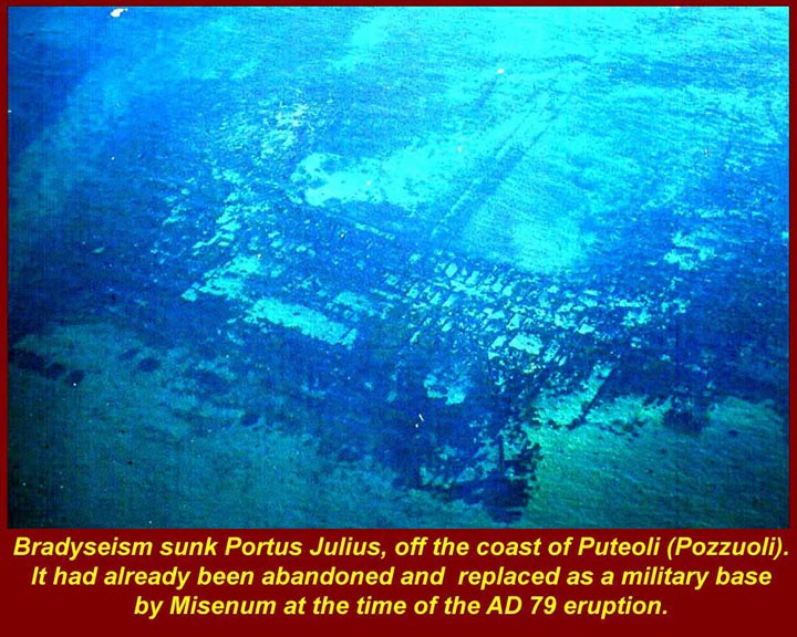
In front of Baiae was Portus Julius, the early imperial navy port that
had already been abandoned by the time of the 79 AD eruption, because
it was too shallow to take large new Roman warships. Another
image, below, will show the remains of Portus Julius.
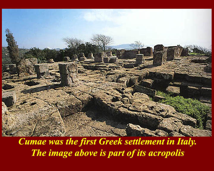
http://www.mmdtkw.org/ALRIVes0823CumaeAcropolis.jpg
The acropolis of Cumae started as a hilltop fortress of colonizing
Greeks -- it was the first Greek colony on the Italian mainland.
As the town grew in size and power, it spread southward into
lower-lying fields, and the Acropolis gradually became the abode of
religious and administrative functions of the colony. Although it
eventually came under Roman sway, it, like Neapolis, kept its "Greek"
or at least pseudo-Greek character -- and this largely because the
Romans wanted a "Greek" place to visit. Only the foundations and
caves of Cumae have survived the centuries.
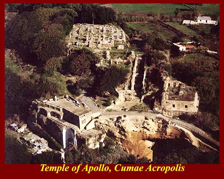
http://www.mmdtkw.org/ALRIVes0824CumaeApolloTemple2.jpg
An aerial view of the Cumae acropolis and Temple of Apollo
complex. The modern building at the bottom of the picture is the
archeological museum. The entrance to the Sibyl's Cave and to the
Grotto of Cocceius is at the very bottom right of the image.
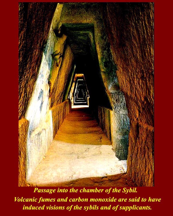
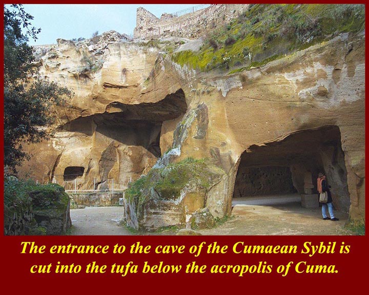
http://www.mmdtkw.org/ALRIVes0826CumaeSybilCave.jpg
The entrance to the cave of the Sibyl is through a long hall cut
through the yellow tufa. There are sunlit openings on one side
and niches -- perhaps for statues or offerings -- on the interior
side. The light streaming in from the side ensures that visitors
were dazzled as they entered the dark inner chamber, which may
originally have been a cistern or communal grain storage room. To
one side of the entrance of the chamber is a niche with what appears to
be a seat or throne, identified as the throne of the Sibyl.
http://www.mmdtkw.org/ALRIVes0827CumaeSybilChamber.jpg
The upper image is of the inside end of the entrance tunnel and the
niche of the Sibyl's throne. The chamber is now lit for the
tourist trade. The lower image is a schematic plan of the tunnels
under the acropolis including the Sibyl's cave.
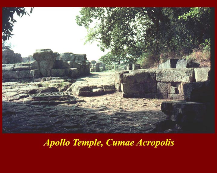
http://www.mmdtkw.org/ALRIVes0828CumaeTufa.jpg
The Cumae ends of the Grotto of Cocceius and the entrance to the
Sibyl's cave meet below the acropolis. Part of the ruins of the
Apollo Temple Complex are at the very top of the picture.
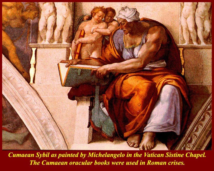
http://www.mmdtkw.org/ALRIVes0829CumaeSybilMichelangelo.jpg
The Cumaean Sibyl that Michelangelo painted on the ceiling of the
Vatican Sistine Chapel. Her robust image here belies her
legend: Apollo fell in love with Daphne, the daughter of the
Theban Tieresius and granted her a wish; she asked to live for as
many years as there were grains in the handful of dust she had just
picked up (more than a thousand); Dafne spurned Apollo's love,
but the wish was still granted; but Apollo unkindly withheld eternal
youth that Daphne had failed to explicitly request; and thus the
Cumaean Sibyl was a wizened ancient.
The ancient Romans consulted the books of Cumaean Sibylline oracles for
hints on how to handle crises of state, and various Consuls, Generals,
and Emperors went to Cumae to consult the old woman in the cave (Greek Ke-bele = "cave dweller") --
supposedly the same ancient prophetess that told Aeneas where to settle
in Italy.
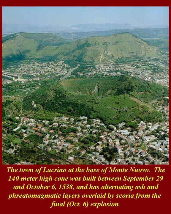
http://www.mmdtkw.org/ALRIVes0830LucrinoMontenuovo.jpg The town of Lucrino hugs the flanks of Monte Nuovo, which grew to
140 meters between September 29 and October 6, 1538. The eruption
was preceded by earth tremors and rapid uplift of the site, and
then the ground cracked and lava, ash and breccia spewed out. The
eruption quieted after a few days and many local folks climbed the
crater. A sudden explosive eruption on October 6 blew out one
side of the crater killing a crowd of the curious. That was the
last real eruption in the Campi Flegrei, but there have been
intermittent rumblings and uplifts ever since. Modern Pozzuoli
was evacuated in the 1970s and '80s when rapid uplifts occurred there,
but nothing happened and the people eventually were allowed to
return. Vulcanologists, using the most modern equipment, have
estimated that a three-hundred-cubic-kilometer pool of magma lies about
one kilometer below the surface of the Naples Bay caldera. The
potential outlets for the pool are Vesuvius and the campi
Flegrei.
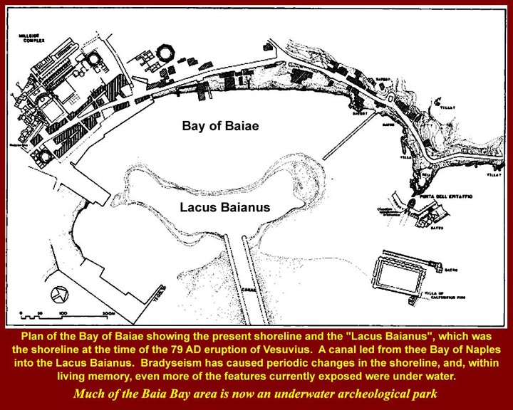
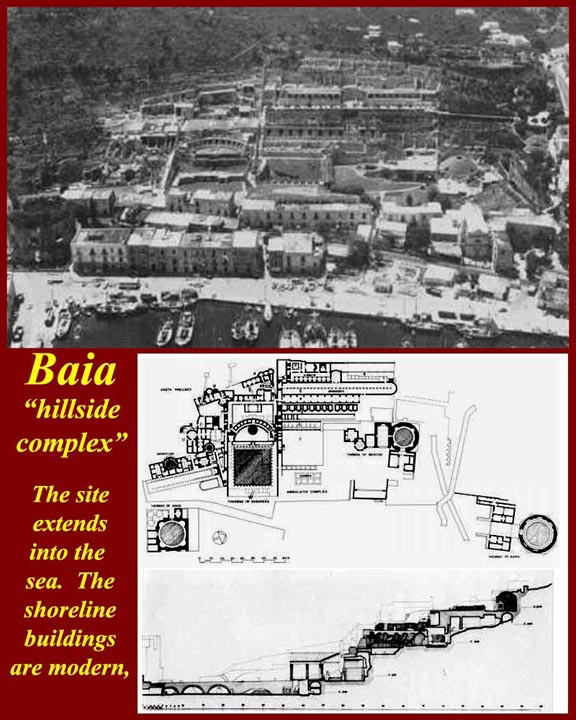
http://www.mmdtkw.org/ALRIVes0831Shorelines.jpg
This sketch map shows the ancient and modern shorelines of Baiae and
ancient inshore structures, the ruins of which survive. The
enclosed harbor is now dry land due to uplift, but it is clear that in
ancient times the shoreline outside the harbor was further out to
sea. There were also structures build out into the sea in pilings
outside the harbor.
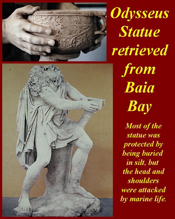
http://www.mmdtkw.org/ALRIVes0833OdysseusBaiae.jpg
A fine statue of Odysseus retrieved from the Nymphaeum in the submerged
Palace of Claudius off the coast of Baiae. The statue was buried in
sediment from the shoulders down, and the head and neck, which were not
protected by the sediment were eaten away by boring mussels. The
preserved parts of the statue, like the bowl held by Odysseus, are
extremely well preserved.
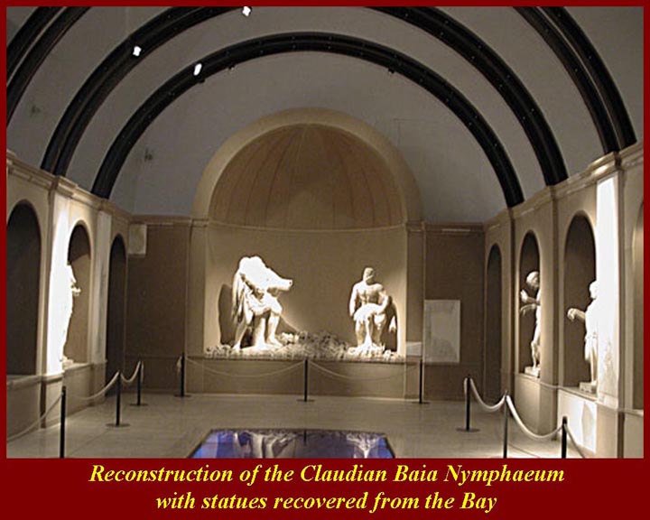
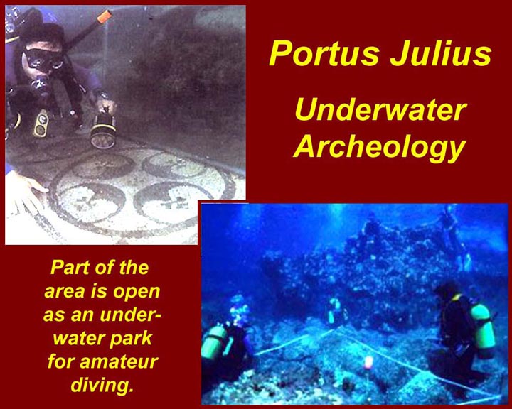
http://www.mmdtkw.org/ALRIVes0835Bradyseism.jpg The Claudian Palace complex and the outer harbor of ancient Baiae
(Portus Julius) are now submerged due to bradyseism (Greek = slow
movement of the earth surface). Part of the area is now an
underwater archeological park which is open to guided amateur
divers.
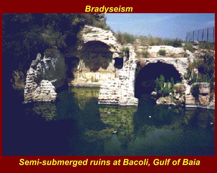
http://www.mmdtkw.org/ALRIVes0837SemisubRuins.jpg
Semi-submerged ruins of baths at Bacoli, Baia Bay. There were
dozens of baths along the coast fed by hydrothermal springs. Some
are still in use -- all are horribly sulfurous.
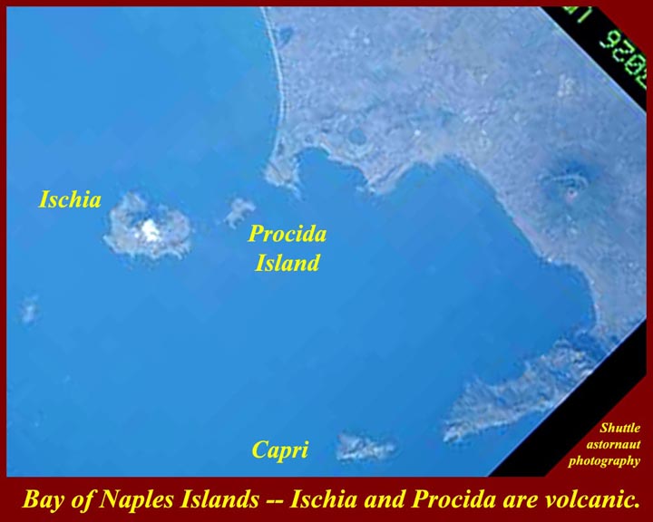
http://www.mmdtkw.org/ALRIVes0838NaplesBayIslandsSatellite.jpg
A photo taken by shuttle astronauts shows the entire bay of naples and
the Campi Flegrei volcanic field. Ischia and Procida Island (and
Procida's little sister, Vivara) are volcanic, but Capri at the
southern end of the Bay of Naples is part of the pre-existing mountain
ridge that bounds the southern end of the Naples bay Caldera. The
distance between Capo Miseno and Punto Campanella (at the tip of the
southern peninsula is 20 miles. Campanian ignimbrite has been
found on the southern slopes of Mt. Lattari, the 1000 meter ridge of
the southern peninsula. That means the pyroclastic flow of the
Campanian ignimbrite eruption traveled 20 miles over water and still
had enough force to push up and over the ridge. Nothing alive in
the Bay or on land around the Bay could have survived the explosion and
the superheated flow.


